Delhi and Vicinity histrotical map 1962 City Plan
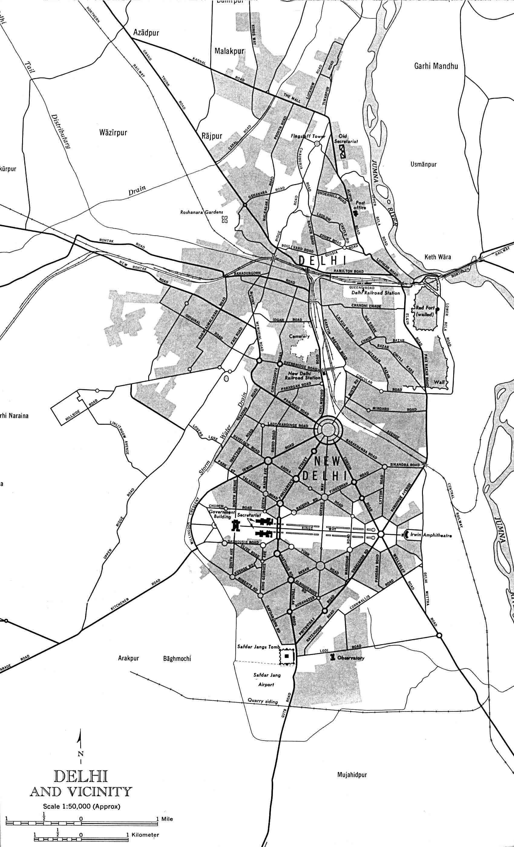
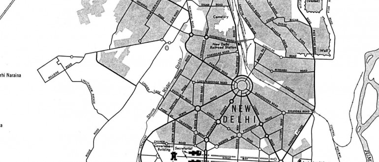
Delhi and Vicinity histrotical map 1962 City Plan


 Calcutta map 1945 City PlanBombay India historical map 1954 City PlanHistoric maps british IndiaHistorical map IndiaDamao Daman 1954 Topographic India MapHistorical map India 1808Bombay India historical map 1909Bhuj Anjar Area Gujarat Topographic Map 1955India historical map 1700 1792 from The Historical AtlasIndia historical mapIndia historical map 1882, Commerce and Commercial NavigationIndia historical map 1760 from The Public Schools Historical AtlasIndia map 1760India historical map mogulHistorical map of India in 1760Wikipedia oldmysore India mapHistorical map of India 1809Historical maps India in 1804Bombay North 1954 Topographic MapBombay South 1954 Topographic Map
 Delhi and Agra Operational Navigation Chart
 Location of Delhi
 Delhi Location
 India citys map
 Map of India airport city states
 India city scale map
 Large city population density India map
 India regions citys map
 South asia India satellite map
 Indien map 2006
 Indien bundesstaaten und unionsterritorien map
 Religions map of India 1987
 Railway network map
 Rivers India map
 Rivers and lakes India map