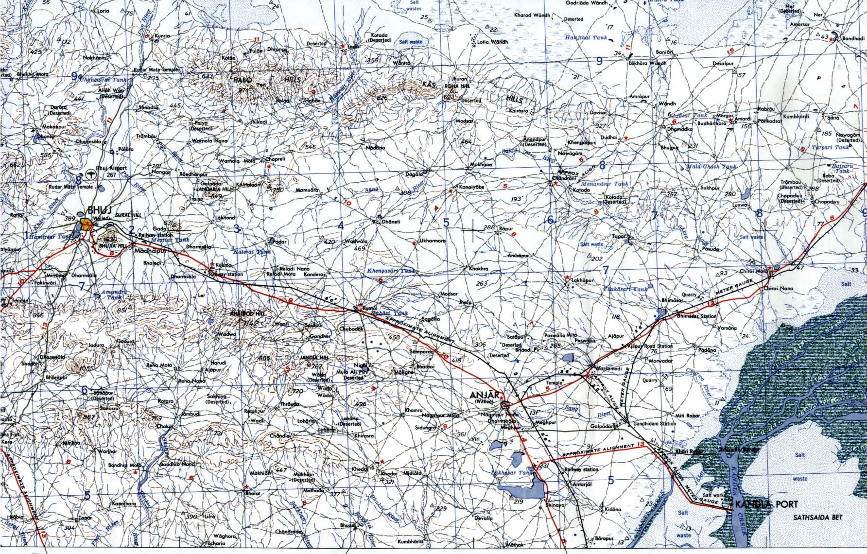
Bhuj-Anjar-Area-Gujarat-Topographic-Map-1955
India Maps
 Rivers and lakes India map
 Damao Daman 1954 Topographic India Map
 Large city population density India map
 Language travel from India map
 Shared relief map of India 1979
 India map
 Map India
 Crop areas map of india 1973
 Alphabetisierungsrate indien karte
 Bombay North 1954 Topographic Map
 India location world map
 India relief map
 Cultural regional areas of india map
 Distribution of christians in Indian states map
 Bombay India historical map 1954 City Plan
 India historical map 1700 1792 from The Historical Atlas
 India china border western sector 1980
 India city scale map
 India historical map 1760 from The Public Schools Historical Atlas
 India numbered stats
 India geographical map
 Small map of india
 India physical
 Rivers India map
 Indian railways map
 Relief of India
 India geological regions map
 India languages map
 India calcutta map
 Delhi Location
 Political map of India 1996
 India physio map 2001
 Map extreme points of India
 India map 1760
 Languages and religions map of India 1973