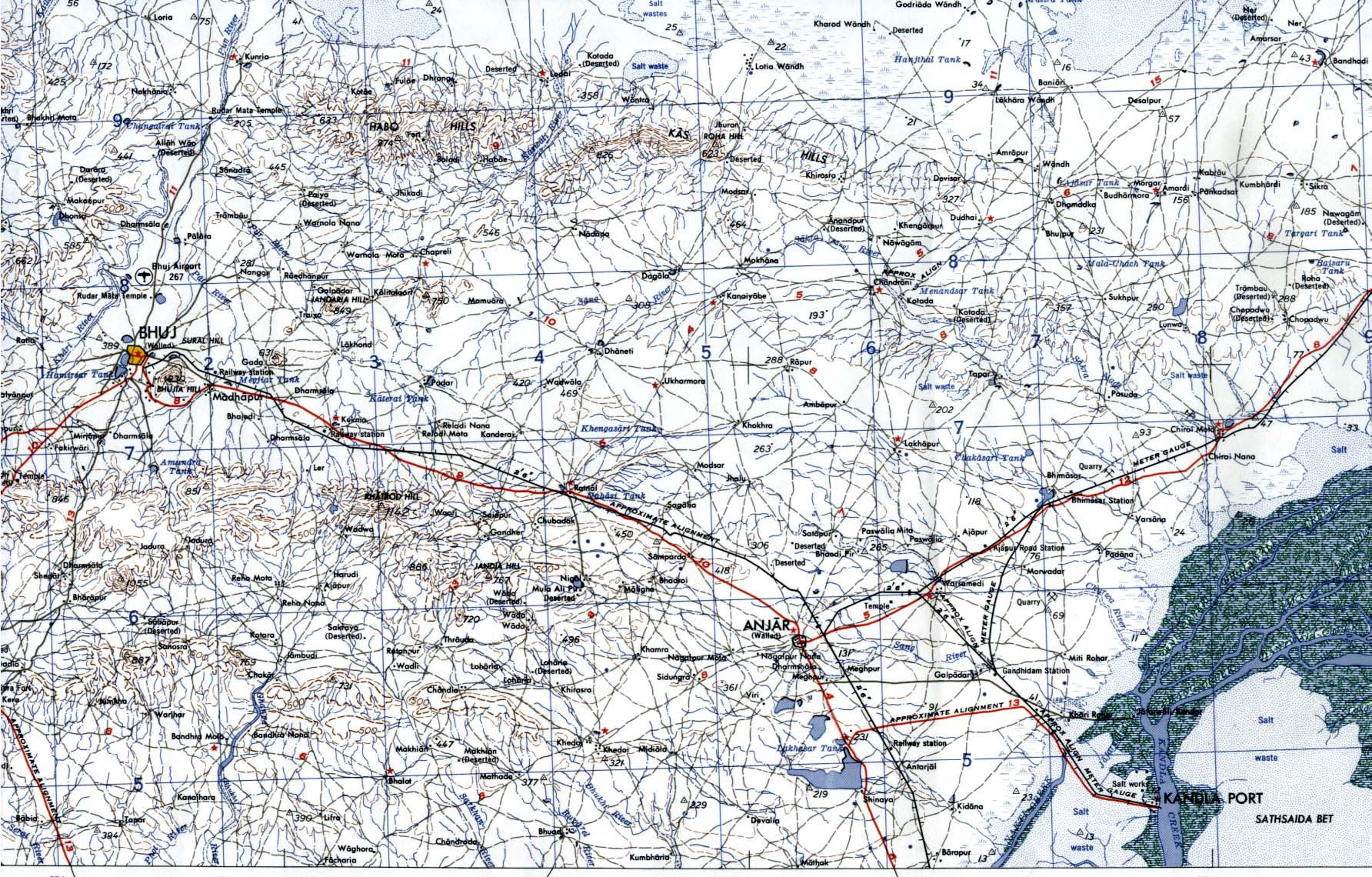
Bhuj-Anjar-Area-Gujarat-Topographic-Map-1955
India Maps
 Bombay India historical map 1954 City Plan
 India topographic blank map
 China India border eastern sector 1988
 India languages map
 Population map of India 1973
 India topogaphy
 Map extreme points of India
 Political map of India 2001
 Bombay Map Tactical Pilotage Chart
 India stats map
 India South asia Map
 India satellite map
 Distribution of christians in Indian states map
 India districts map
 India regions citys map
 Large city population density India map
 Shared relief map of India 1979
 Religions map of India 1987
 Bombay North 1954 Topographic Map
 Historic maps british India
 Karte indien bundesstaaten unionsterritorien
 India ter map
 India airports and seaports map
 India china border western sector 1980
 Historical map India
 Railway network map
 India historical map mogul
 Indien map 2006
 India historical map 1700 1792 from The Historical Atlas
 China India border western sector 1988
 India city scale map
 India geology map
 West India map
 India flag map
 Language travel from India map