population-map-of-india-1973
India Maps
 Map extreme points of India
 Delhi Location
 Karte indien bundesstaaten unionsterritorien
 Small map of india
 Rivers and lakes India map
 India locator map blank
 India states numbered map
 India national roads map
 India stats map
 India natural hazards map
 Map of India airport city states
 Crop areas map of india 1973
 India flag
 Historical map India
 Damao Daman 1954 Topographic India Map
 Bombay Map Tactical Pilotage Chart
 Physical features of India map
 Indien bundesstaaten und unionsterritorien map
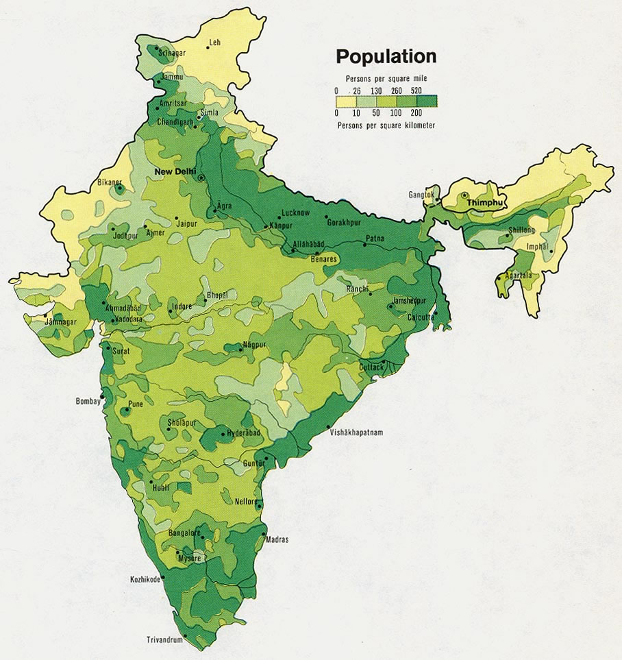
 Population map of India 1973
 India relief map
 Distribution of christians in Indian states map
 India energy map 1997
 India South asia Map
 Indien map 2006
 Wikipedia oldmysore India map
 Airports and seaports map
 india wfb map
 South asia India satellite map
 India historical map mogul
 India comptoirs map
 Indian railways map
 India geographical map
 Railway network schematic map
 Map of india
 India geological regions map