india-topogaphy
India Maps
 India historical map
 India natural hazards map
 South India regions map
 India small map
 Distribution of christians in Indian states map
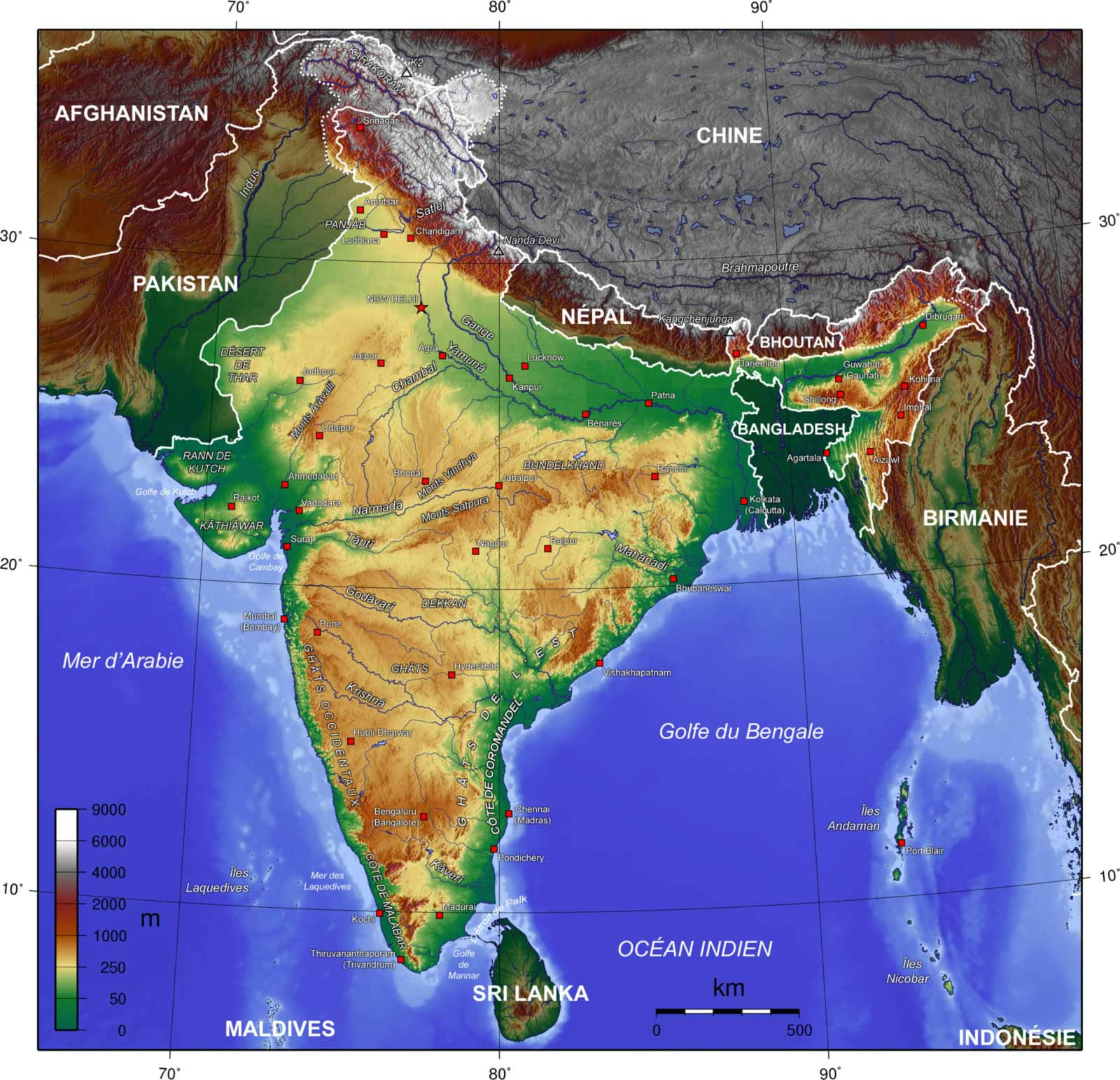
 Map of relief India
 Airports and seaports map
 India historical map 1700 1792 from The Historical Atlas
 India railway schematic map
 India map bbsr direct train full
 India flag map
 South asia local India map
 India physical map
 India physio map 2001
 Alphabetisierungsrate indien karte
 India national roads map
 India regions citys map
 India historical map mogul
 Indian railways map
 Historical map of India in 1760
 Relief of India
 India citys map
 Population map of India 1973
 Where India located
 Cultural regional areas of india map
 India map
 Karte indien bundesstaaten unionsterritorien
 Calcutta map 1945 City Plan
 India geographical map
 Language travel from India map
 Bombay South 1954 Topographic Map
 India numbered stats
 India locator map blank
 India calcutta map
 Delhi and Agra Operational Navigation Chart