Bombay-South-1954-Topographic-Map
India Maps
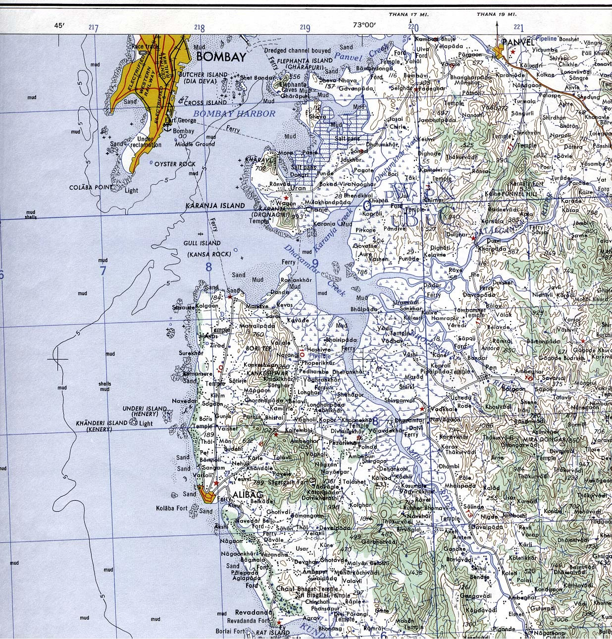
 Bombay South 1954 Topographic Map
 Historical map India 1808
 India map bbsr direct train full
 India topogaphy
 India numbered stats
 India states numbered map
 Indian railways map
 Map of relief India
 Where India located
 India calcutta map
 Airports and seaports map
 Blank colored India map
 Relief of India
 Delhi Location
 India map
 China India border eastern sector 1988
 India comptoirs map
 india wfb map
 India districts map
 Bhuj Anjar Area Gujarat Topographic Map 1955
 Crop areas map of india 1973
 Historic maps british India
 Distribution of christians in Indian states map
 India pakistan physical map
 India historical map
 Political map of India 1996
 India ter map
 Rivers India map
 Shared relief map of India 1979
 Rivers map of India
 India city scale map
 Historical map India
 Karte indien bundesstaaten unionsterritorien
 India historical map 1700 1792 from The Historical Atlas
 Political map of India 2001