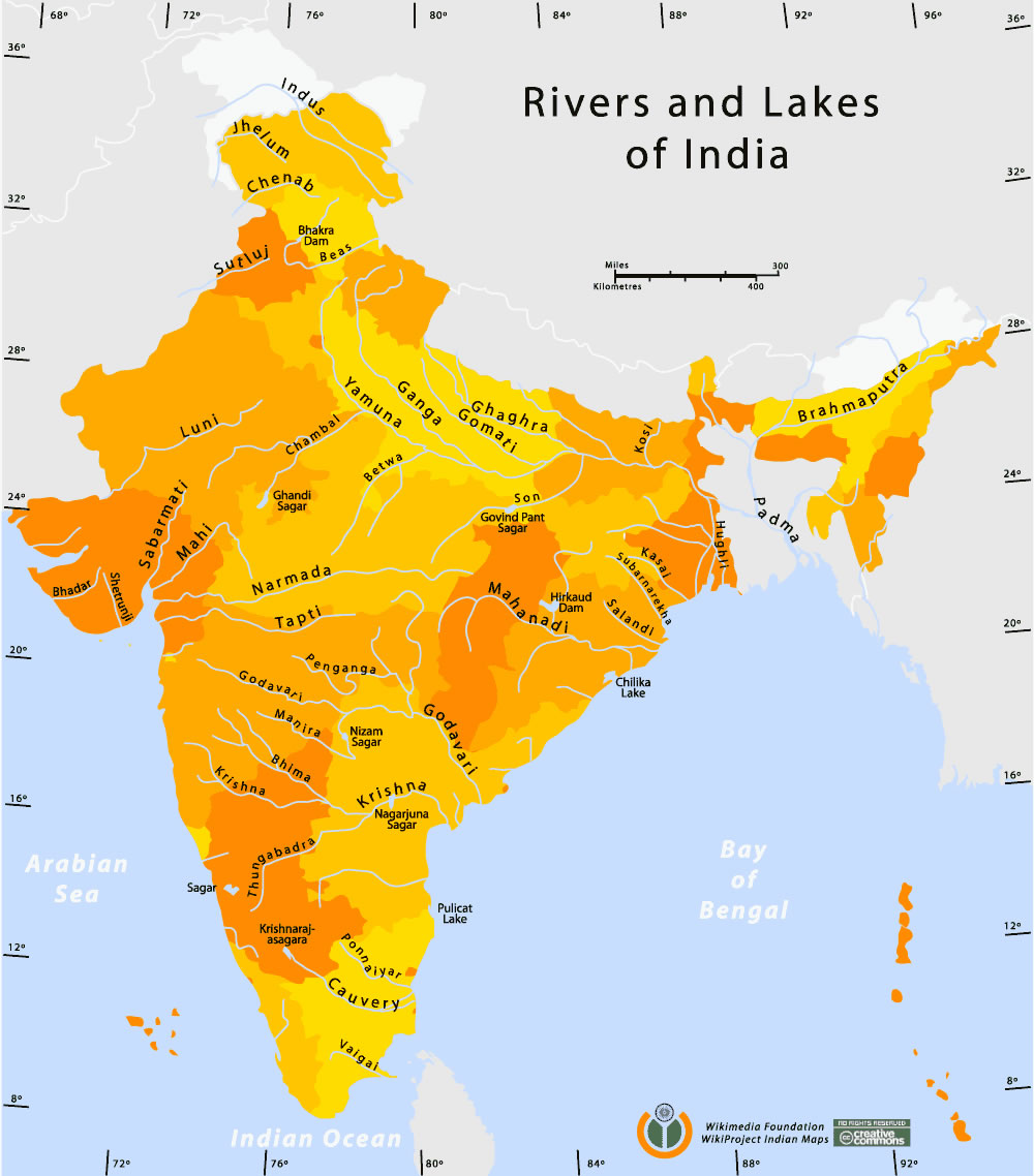
Rivers-and-lakes-india-map
India Maps
 Airports and seaports map
 Bombay South 1954 Topographic Map
 India districts map
 Bombay North 1954 Topographic Map
 Map of India airport city states
 The india map
 India satellite map
 Population density India map
 india wfb map
 Indien map 2006
 India South asia Map
 Damao Daman 1954 Topographic India Map
 India city scale map
 South India regions map
 Map India
 India tourist map
 Cultural regional areas of india map
 Historical map India 1808
 Religions map of India 1987
 India disputed areas map
 India airports and seaports map
 India pakistan physical map
 Shared relief map of India 1979
 Bhuj Anjar Area Gujarat Topographic Map 1955
 India physical map
 India historical map 1760 from The Public Schools Historical Atlas
 Large city population density India map
 India geology zones
 India natural hazards map
 India historical map mogul
 Relief of India
 India ter map
 India stats map
 India states by rto codes map
 India
India