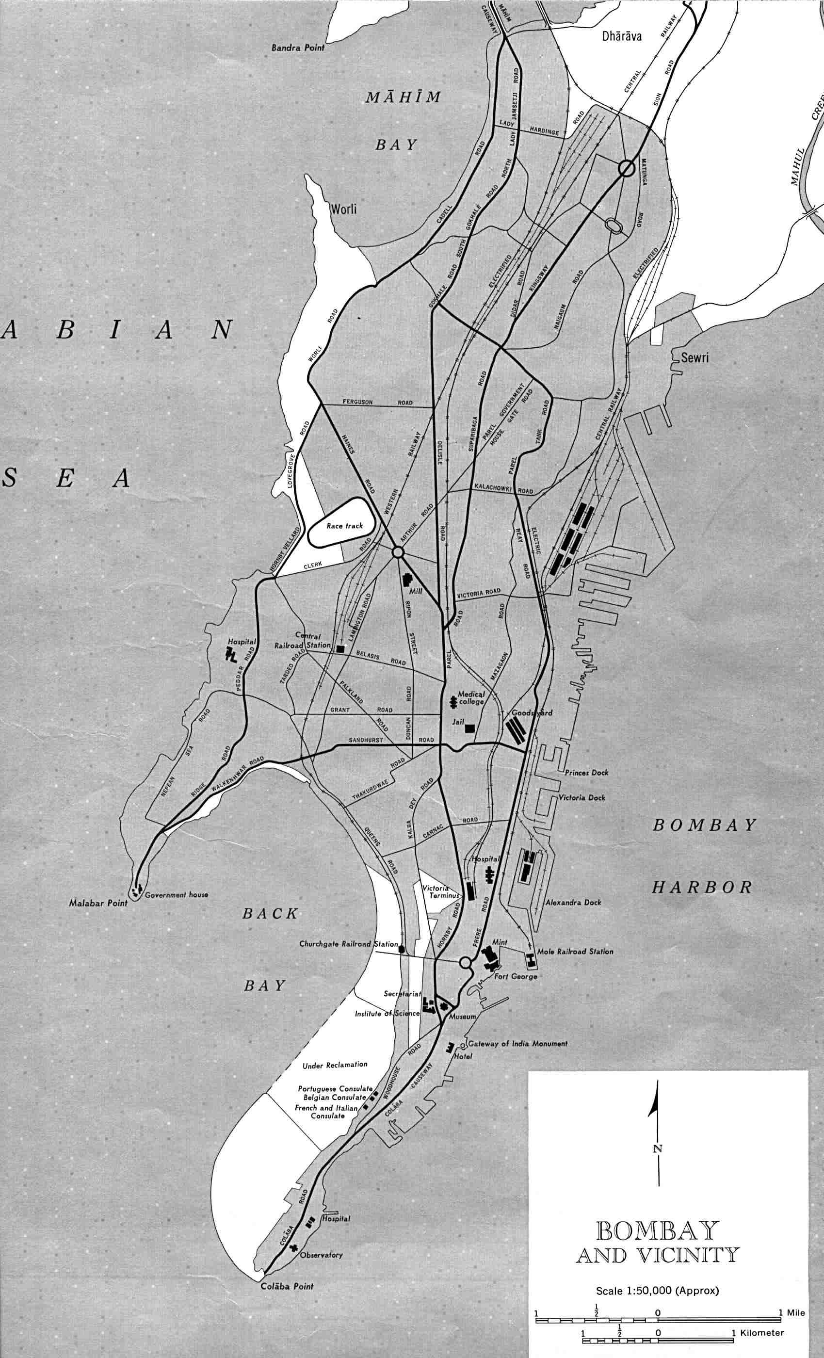
Bombay-india-historical-map-1954-City-Plan
India Maps
 India languages map
 India physical
 India numbered stats
 Bhuj Anjar Area Gujarat Topographic Map 1955
 Population map of India 1973
 Rivers map of India
 China India border eastern sector 1988
 Relief map of India 1996
 Wikipedia oldmysore India map
 Delhi and Vicinity histrotical map 1962 City Plan
 India satellite map
 Rivers and lakes India map
 India locator map blank
 India comptoirs map
 india wfb map
 India geology map
 Large city population density India map
 State and union territories India map
 India Transportation map
 India
India Rivers and lakes topographic map
 India natural hazards map
 Indien bundesstaaten und unionsterritorien map
 China India border western sector 1988
 Distribution of christians in Indian states map
 Bombay India historical map 1909
 India geological regions map
 India states by rto codes map
 Historical map India
 India china border western sector 1980
 India flag
 India topographic blank map
 Shared relief map of India 1979
 Crop areas map of india 1973
 Calcutta map 1945 City Plan