map-of-india-airport-city-states
India Maps
 Historical map India
 Physical features of India map
 India districts map
 Location of Delhi
 Topographic India map
 India physical
 Blank colored India map
 India airports and seaports map
 Population map of India 1973
 India energy map 1997
 India geological regions map
 Bombay Map Tactical Pilotage Chart
 India geology map
 India topographic blank map
 States and union territories of India
 Rivers and lakes topographic map
 India historical map 1882, Commerce and Commercial Navigation
 India map bbsr direct train full
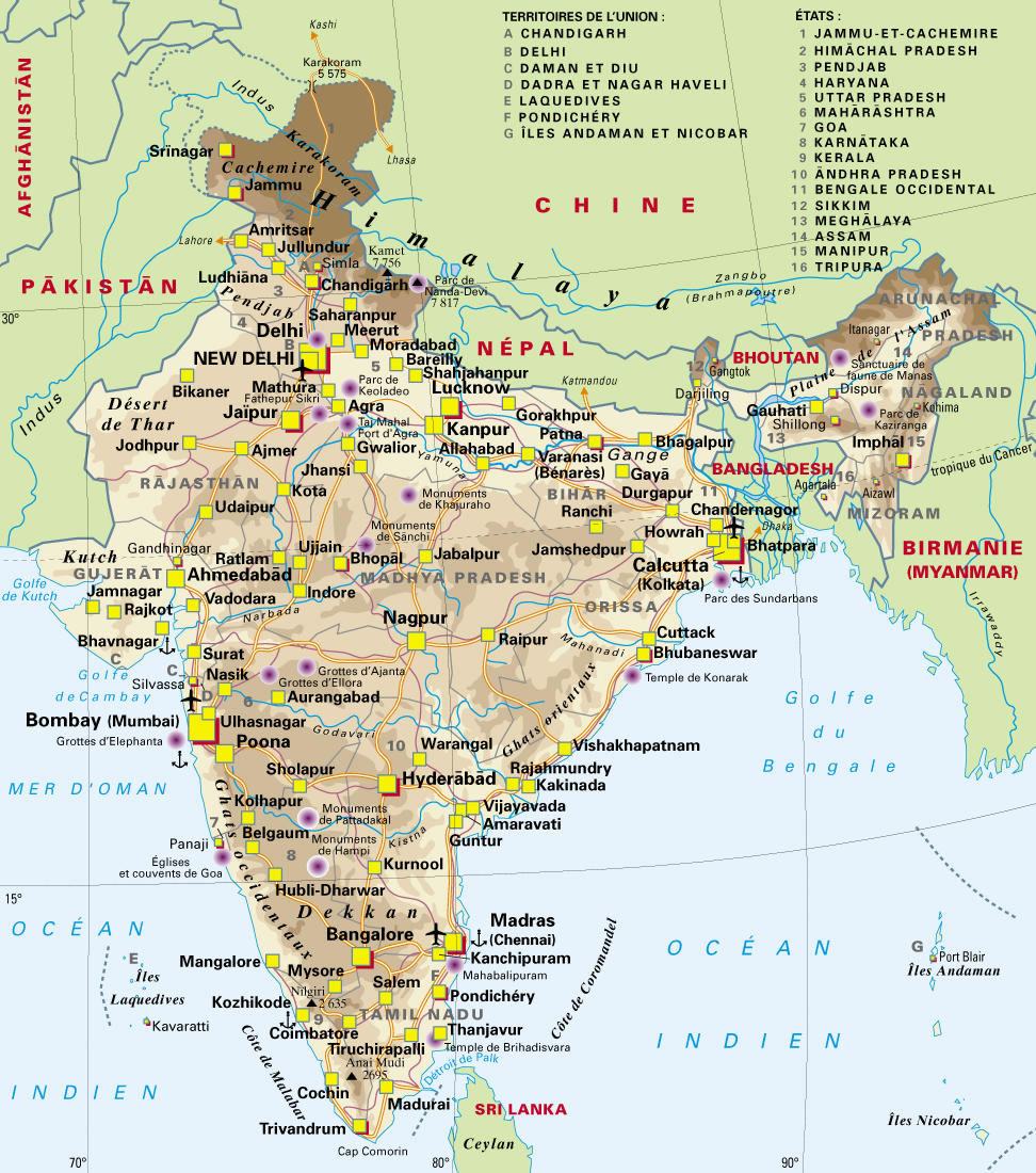
 India states numbered map
 India map
 India numbered stats
 India languages map
 India satellite map
 China India border eastern sector 1988
 Map of relief India
 Damao Daman 1954 Topographic India Map
 Calcutta map 1945 City Plan
 India relief map
 India disputed areas map
 India stats map
 India topogaphy
 South India regions map
 India flag
 South asia India satellite map
 India historical map 1760 from The Public Schools Historical Atlas