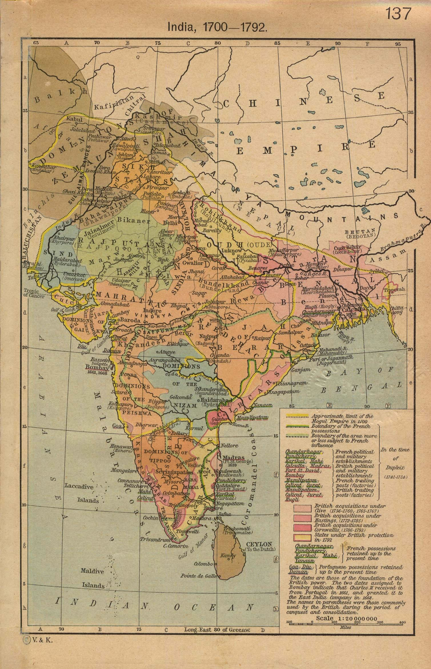
india-historical-map-1700-1792-from-The-Historical-Atlas
India Maps
 Delhi and Agra Operational Navigation Chart
 Language travel from India map
 India numbered stats
 India states by rto codes map
 Bhuj Anjar Area Gujarat Topographic Map 1955
 Political map of India 1996
 Bombay India historical map 1954 City Plan
 Historic maps british India
 India map
 Religions map of India 1987
 Political map of India 2001
 Topographic India map
 India national roads map
 Railway network map
 Calcutta map 1945 City Plan
 South asia India satellite map
 Bombay North 1954 Topographic Map
 India geology zones
 Population density India map
 India topographic blank map
 Cultural regional areas of india map
 India climatic zone map
 India states numbered map
 India pakistan physical map
 India relief map
 The india map
 Delhi Location
 Rivers and lakes India map
 India city scale map
 India comptoirs map
 India map 1760
 India china border western sector 1980
 South India regions map
 India ter map
 Where India located