india-physio-map-2001
India Maps
 Alphabetisierungsrate indien karte
 Bombay India historical map 1954 City Plan
 India historical map 1760 from The Public Schools Historical Atlas
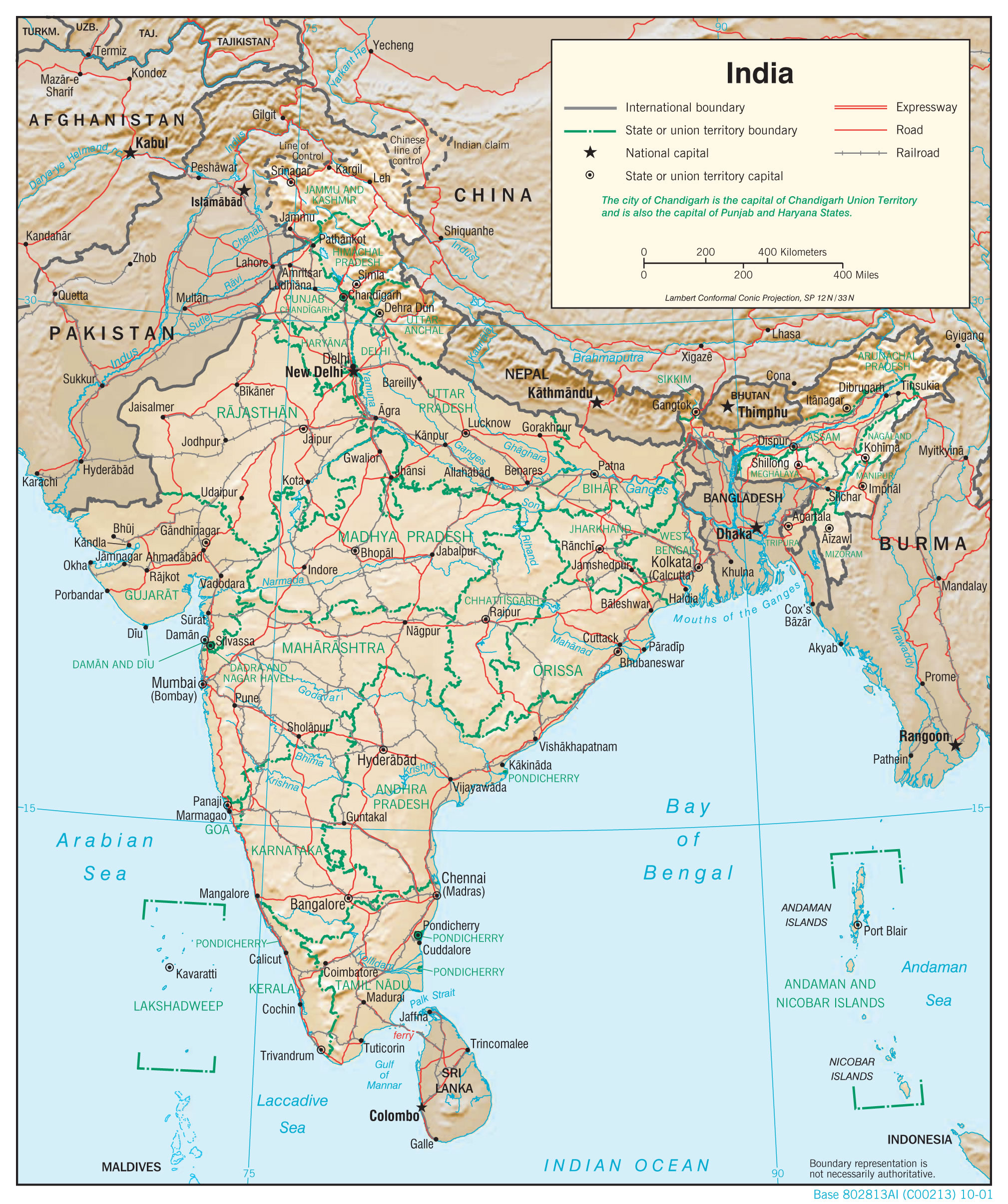
 India physio map 2001
 Karte indien bundesstaaten unionsterritorien
 India railway schematic map
 India disputed areas map
 India flag map
 China India border eastern sector 1988
 Historical map of India in 1760
 India map 1760
 India relief map
 Map of India airport city states
 Location of Delhi
 Rivers and lakes India map
 Railway network map
 Delhi Location
 Damao Daman 1954 Topographic India Map
 Map of relief India
 India regions citys map
 India numbered stats
 South asia India satellite map
 India pakistan physical map
 India location world map
 The india map
 India map
 Political map of India 2001
 State and union territories India map
 Bombay India historical map 1909
 Historical map of India 1809
 Blank colored India map
 Shared relief map of India 1979
 India stats map
 India comptoirs map
 Bombay Map Tactical Pilotage Chart