india-stats-map
India Maps
 Relief of India
 India pakistan physical map
 India climatic zone map
 India china border western sector 1980
 Rivers map of India
 India location world map
 India states numbered map
 India numbered stats
 Cultural regional areas of india map
 India historical map 1700 1792 from The Historical Atlas
 Rivers India map
 Crop areas map of india 1973
 South asia local India map
 India locator map blank
 India map
 India disputed areas map
 Bombay India historical map 1909
 India satellite map
 Rivers and lakes topographic map
 India relief map
 India flag
 India historical map 1882, Commerce and Commercial Navigation
 India geology map
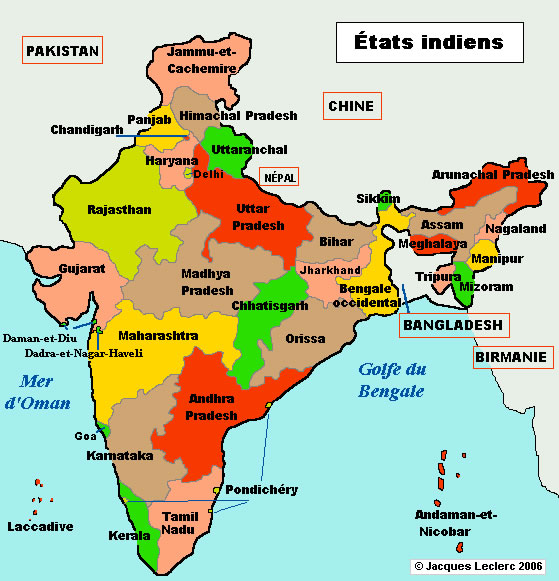
 Political map of India 1996
 India topogaphy
 Delhi and Agra Operational Navigation Chart
 Population density India map
 Map of india
 Blank colored India map
 South India regions map
 Bhuj Anjar Area Gujarat Topographic Map 1955
 South asia local langage map
 Map of relief India
 India geology zones
 Bombay North 1954 Topographic Map