india-states-by-rto-codes-map
India Maps
 China India border western sector 1988
 Relief of India
 India regions citys map
 India stats map
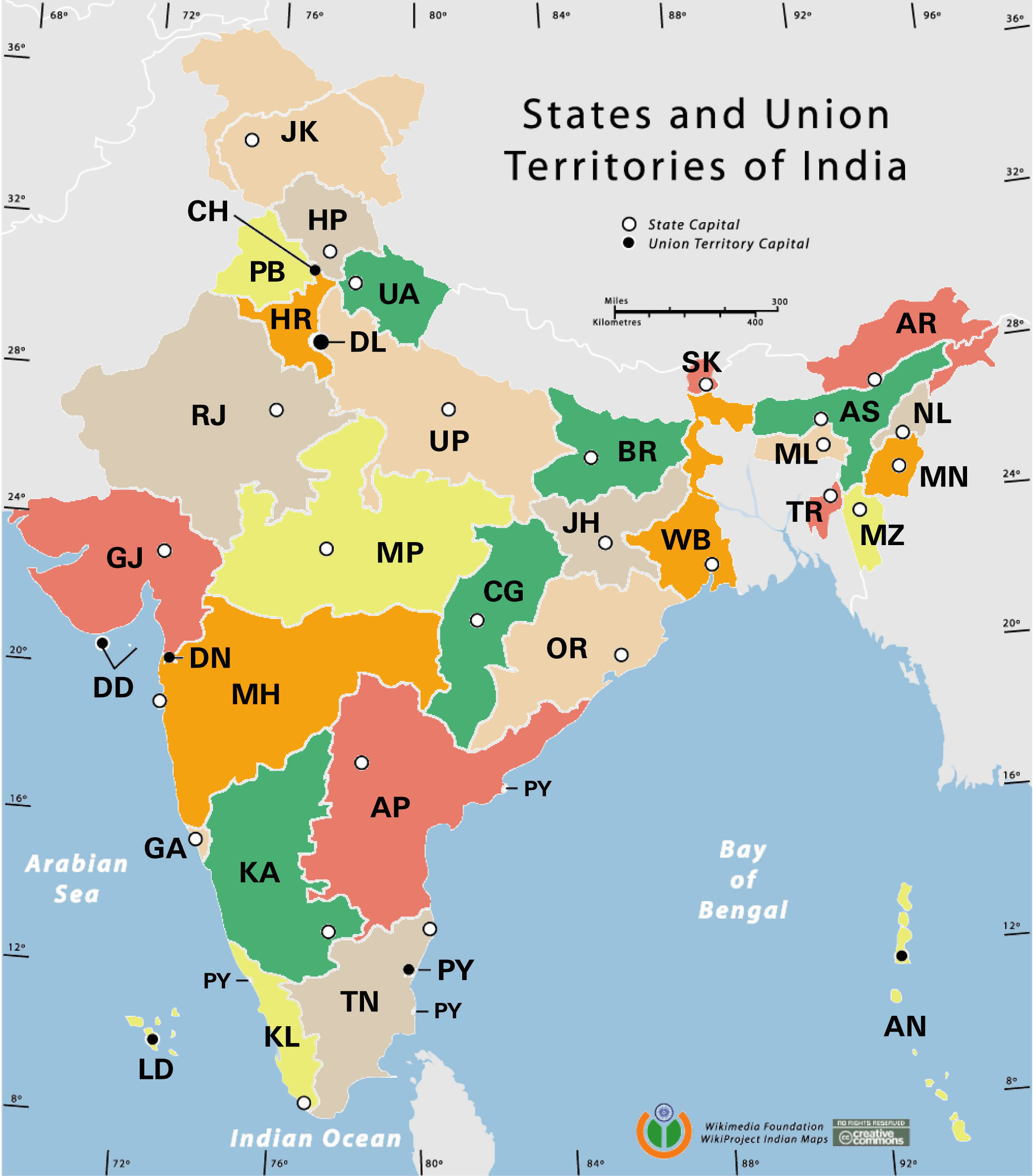
 India historical map 1700 1792 from The Historical Atlas
 State and union territories India map
 Historical map India 1808
 Population density India map
 India location world map
 Indian railways map
 Airports and seaports map
 Relief map of India 1996
 India rajasthan locator map
 India energy map 1997
 South asia local langage map
 Distribution of christians in Indian states map
 India flag map
 India districts map
 India climatic zone map
 Map extreme points of India
 Cultural regional areas of india map
 India locator map blank
 India relief map
 China India border eastern sector 1988
 India
India Map of india
 Damao Daman 1954 Topographic India Map
 Languages and religions map of India 1973
 Rivers India map
 Bombay India historical map 1909
 India geographical map
 India natural hazards map
 Historical map India
 india wfb map
 India physical