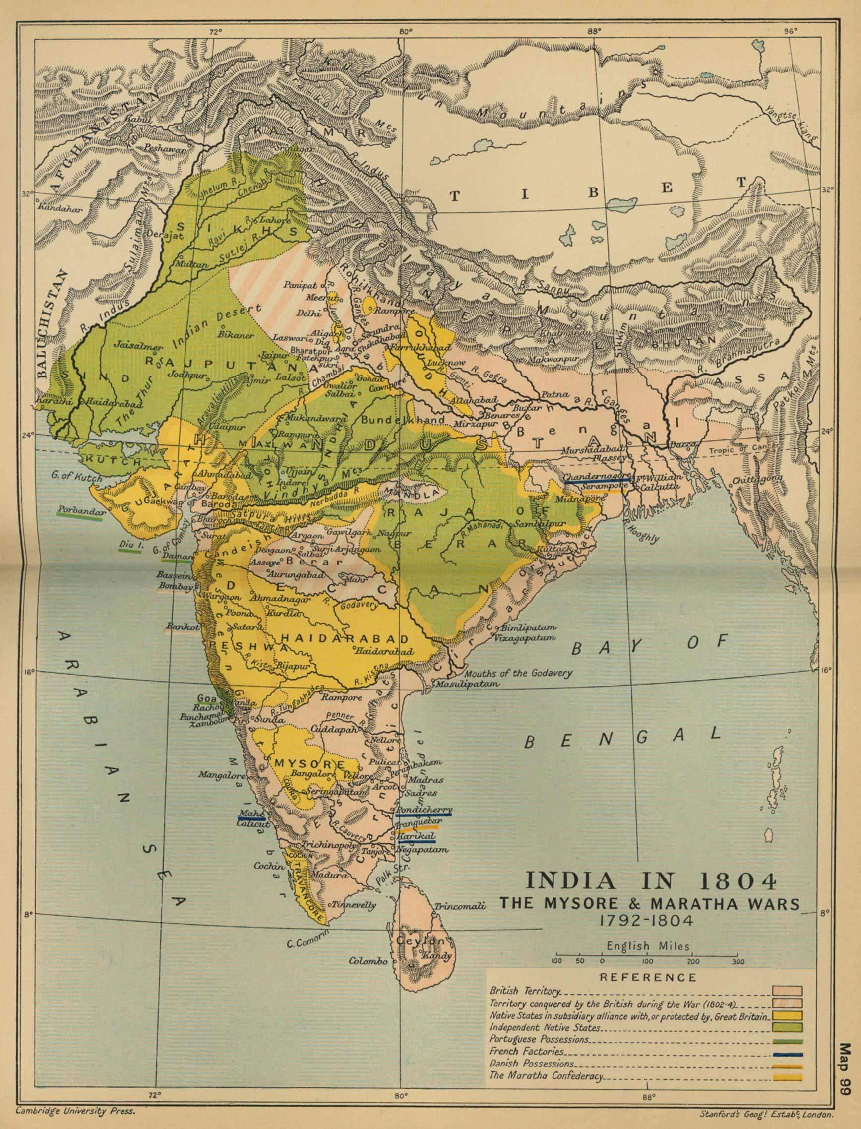
historical-maps-india-in-1804
India Maps
 India historical map mogul
 Map extreme points of India
 Indien bundesstaaten und unionsterritorien map
 Historical map of India in 1760
 India locator map blank
 Delhi Location
 India physical
 India ter map
 india wfb map
 Wikipedia oldmysore India map
 India disputed areas map
 Bombay Map Tactical Pilotage Chart
 India energy map 1997
 India relief map
 India city scale map
 Historical map India 1808
 Bhuj Anjar Area Gujarat Topographic Map 1955
 India South asia Map
 India geological regions map
 Rivers and lakes topographic map
 Karte indien bundesstaaten unionsterritorien
 Bombay South 1954 Topographic Map
 India regions citys map
 India airports and seaports map
 India satellite map
 Language travel from India map
 Damao Daman 1954 Topographic India Map
 Indien map 2006
 India numbered stats
 Historical map of India 1809
 China India border western sector 1988
 State and union territories India map
 Political map of India 1996
 West India map
 Cultural regional areas of india map