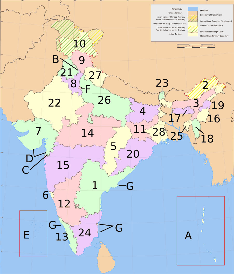
india-states-numbered-map
India Maps
 Bhuj Anjar Area Gujarat Topographic Map 1955
 India languages map
 India national roads map
 Delhi and Vicinity histrotical map 1962 City Plan
 India geology zones
 Indien map 2006
 Relief of India
 India small map
 Damao Daman 1954 Topographic India Map
 Map of india
 Distribution of christians in Indian states map
 Map of India airport city states
 Historical map of India 1809
 Airports and seaports map
 Topographic India map
 India physical
 Bombay Map Tactical Pilotage Chart
 Political map of India 2001
 India railway schematic map
 India energy map 1997
 India regions citys map
 India topogaphy
 India
India India flag map
 india wfb map
 Historical maps India in 1804
 Crop areas map of india 1973
 South asia India satellite map
 India historical map 1760 from The Public Schools Historical Atlas
 Calcutta map 1945 City Plan
 India geographical map
 India physical map
 Languages and religions map of India 1973
 India citys map
 India stats map