historical-map-india
India Maps
 Bombay North 1954 Topographic Map
 Topographic India map
 Large city population density India map
 India regions citys map
 India relief map
 India geology map
 India national roads map
 Historical map of India in 1760
 Religions map of India 1987
 Shared relief map of India 1979
 Map extreme points of India
 India calcutta map
 South India regions map
 India tourist map
 Airports and seaports map
 India states by rto codes map
 Historical map of India 1809
 Relief map of India 1996
 India citys map
 Map India
 Language travel from India map
 Historical maps India in 1804
 India historical map 1760 from The Public Schools Historical Atlas
 Railway network map
 India city scale map
 India physical map
 Map of relief India
 Indien map 2006
 India airports and seaports map
 Crop areas map of india 1973
 China India border western sector 1988
 India topogaphy
 India stats map
 India numbered stats
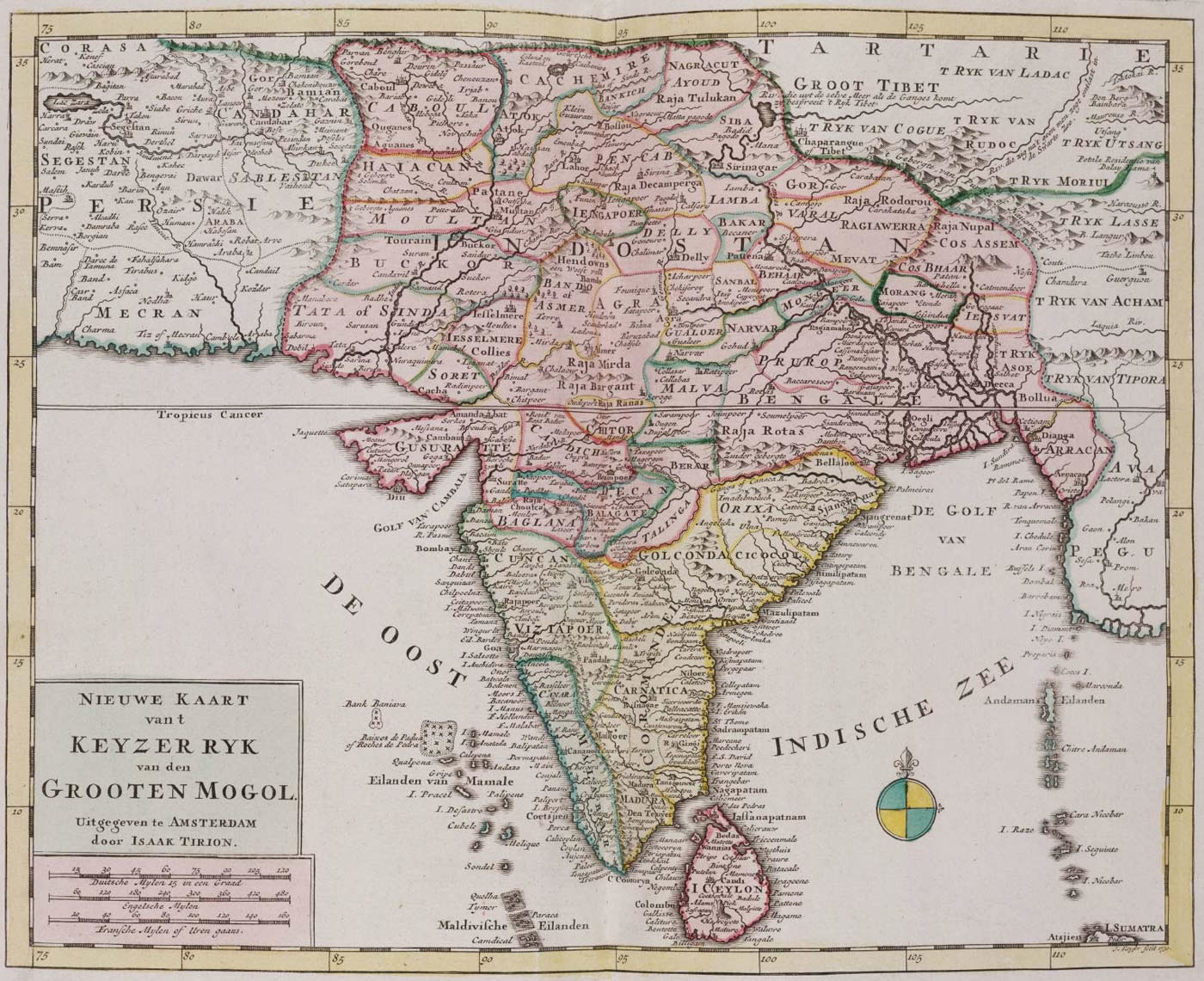
 India historical map mogul