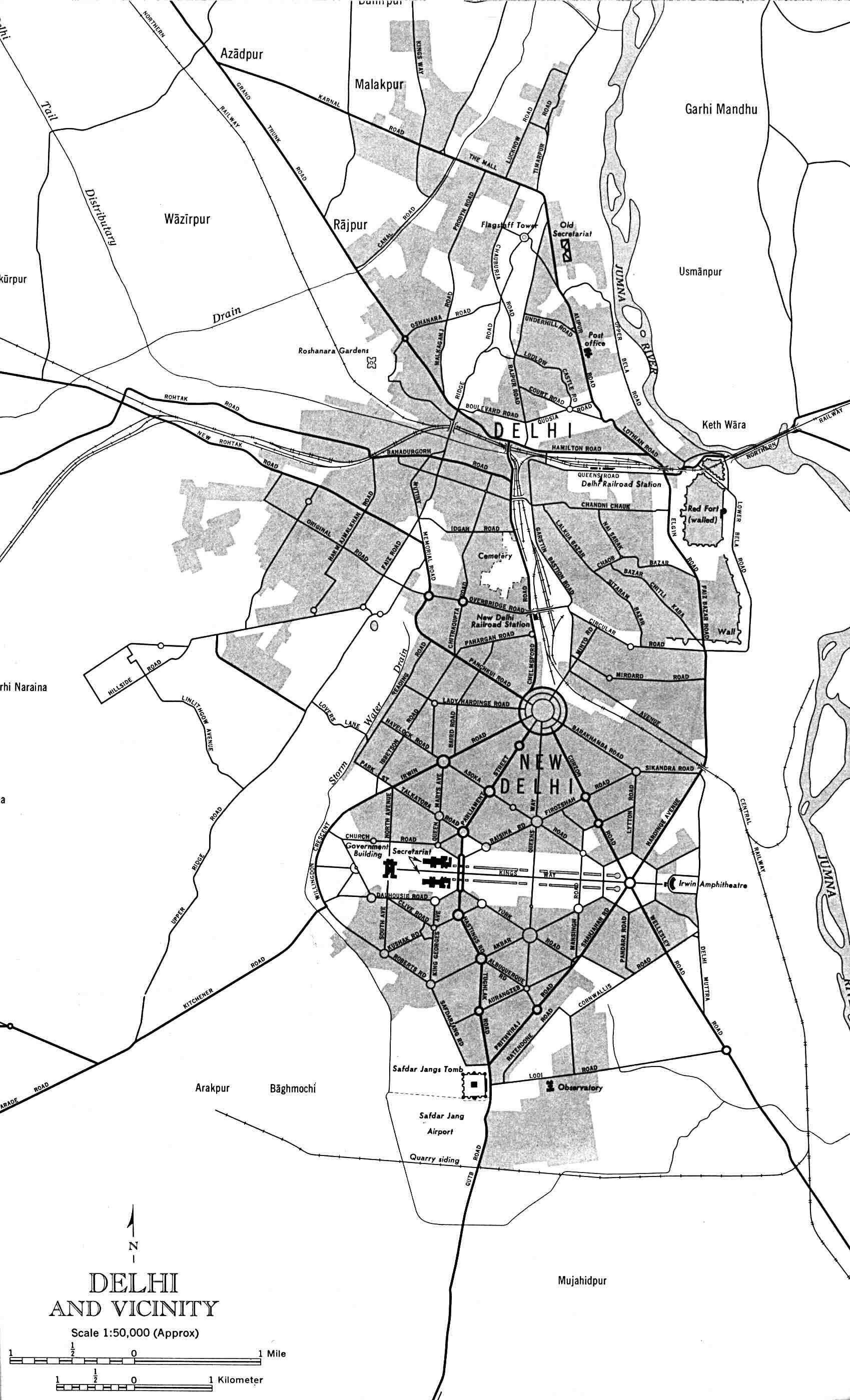
Delhi-and-Vicinity-histrotical-map-1962-City-Plan
India Maps
 China India border western sector 1988
 Bombay North 1954 Topographic Map
 Where India located
 Indian railways map
 The india map
 Delhi Location
 India historical map mogul
 India national roads map
 Railway network map
 Languages and religions map of India 1973
 India physio map 2001
 India languages map
 Historical map India 1808
 India pakistan physical map
 Rivers India map
 India districts map
 India historical map 1760 from The Public Schools Historical Atlas
 Railway network schematic map
 India flag
 Blank colored India map
 Historical map India
 Bombay India historical map 1954 City Plan
 China India border eastern sector 1988
 Bombay India historical map 1909
 India satellite map
 Religions map of India 1987
 India natural hazards map
 Indien map 2006
 India locator map blank
 Large city population density India map
 Historical maps India in 1804
 India relief map
 Alphabetisierungsrate indien karte
 India topogaphy
 Distribution of christians in Indian states map