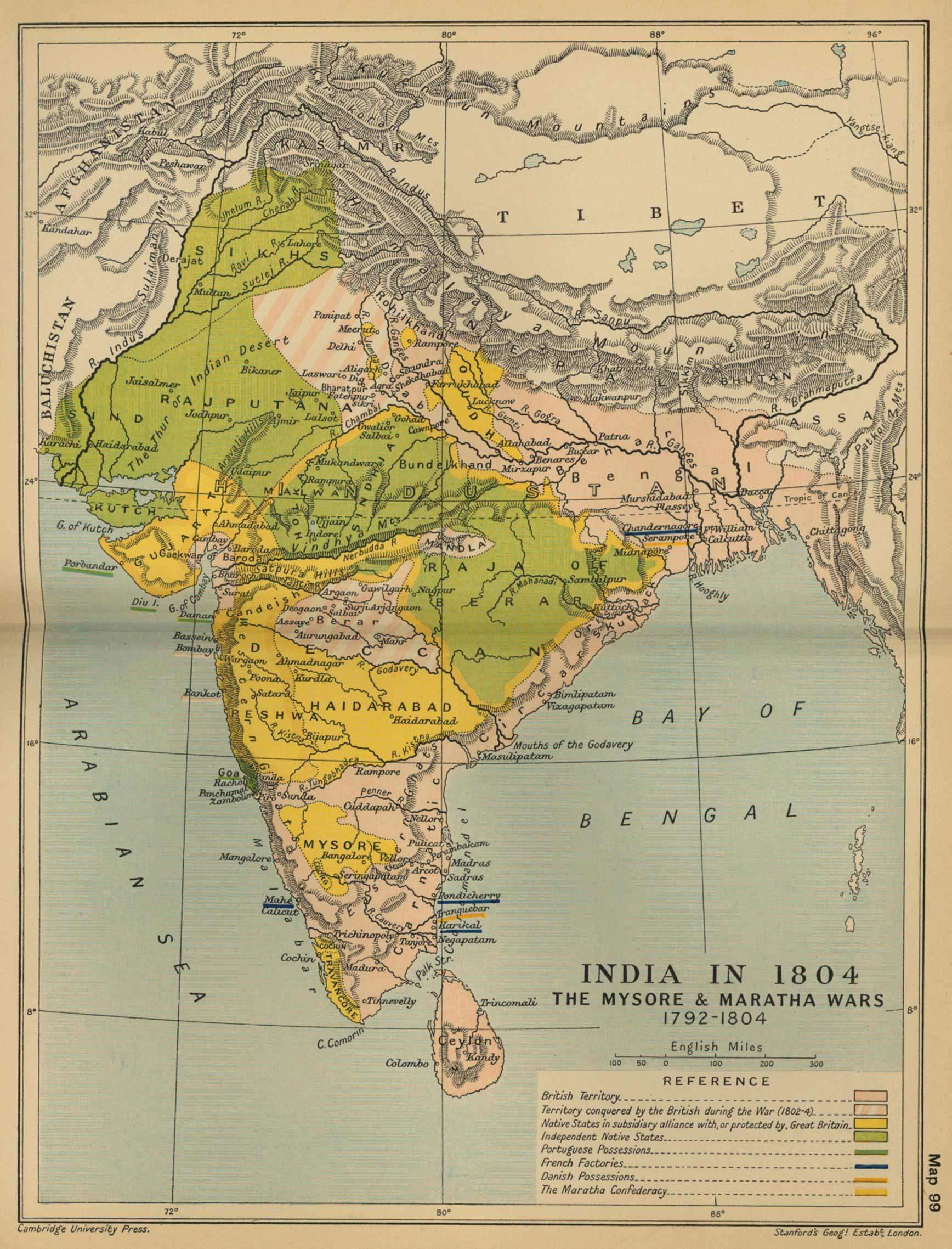
historical-maps-india-in-1804
India Maps
 Language travel from India map
 India Transportation map
 Indien map 2006
 India railway schematic map
 India pakistan physical map
 Population map of India 1973
 india wfb map
 Map of relief India
 India city scale map
 India national roads map
 Languages and religions map of India 1973
 India physical
 China India border western sector 1988
 Map of India airport city states
 Large city population density India map
 Historical map India
 India calcutta map
 India disputed areas map
 India map bbsr direct train full
 Relief map of India 1996
 Bhuj Anjar Area Gujarat Topographic Map 1955
 India location world map
 Political map of India 1996
 South asia local India map
 Blank colored India map
 Map extreme points of India
 India historical map 1760 from The Public Schools Historical Atlas
 West India map
 India comptoirs map
 India energy map 1997
 South asia India satellite map
 Bombay South 1954 Topographic Map
 India states numbered map
 India small map
 Location of Delhi