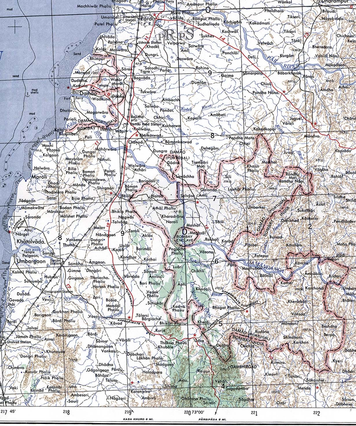
Damao-Daman-1954-Topographic-india-Map
India Maps
 Historic maps british India
 India national roads map
 India china border western sector 1980
 India locator map blank
 India historical map 1700 1792 from The Historical Atlas
 India map 1760
 China India border western sector 1988
 Historical maps India in 1804
 India location world map
 States and union territories of India
 Map extreme points of India
 India ter map
 India relief map
 Political map of India 1996
 India city scale map
 China India border eastern sector 1988
 Small map of india
 India numbered stats
 Map of India airport city states
 Rivers map of India
 India satellite map
 India stats map
 Rivers and lakes India map
 India physical
 Railway network map
 Indian railways map
 Topographic India map
 Alphabetisierungsrate indien karte
 Railway network schematic map
 The india map
 India map bbsr direct train full
 Indien map 2006
 India geographical map
 Physical features of India map
 Historical map of India in 1760