india-railway-schematic-map
India Maps
 China India border eastern sector 1988
 Airports and seaports map
 India languages map
 Historical map India
 India physical map
 India small map
 India climatic zone map
 India geological regions map
 Bombay India historical map 1954 City Plan
 India calcutta map
 South asia India satellite map
 Location of Delhi
 India satellite map
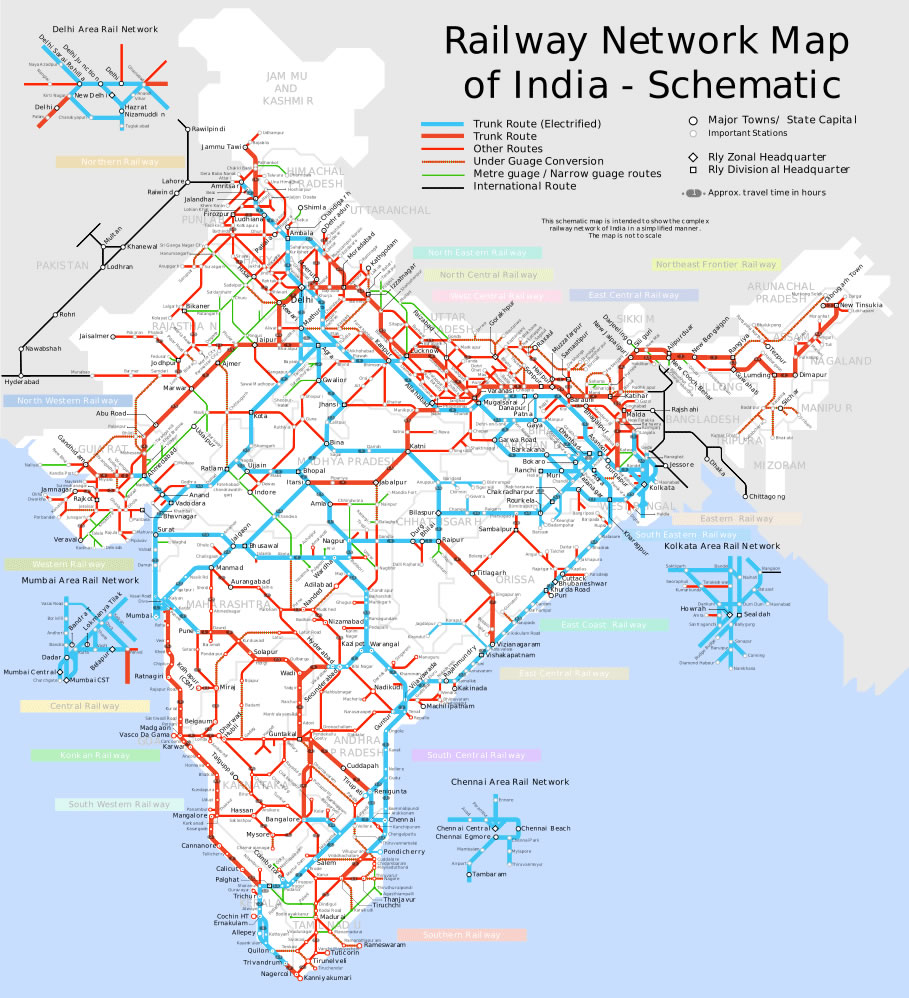
 India railway schematic map
 India flag
 Rivers India map
 India pakistan physical map
 India city scale map
 India geographical map
 Historical map India 1808
 Relief map of India 1996
 Crop areas map of india 1973
 Railway network map
 Blank colored India map
 India topographic blank map
 Bombay India historical map 1909
 Indien bundesstaaten und unionsterritorien map
 Population density India map
 India citys map
 Wikipedia oldmysore India map
 Delhi Location
 Railway network schematic map
 Map of relief India
 India rajasthan locator map
 India geology zones