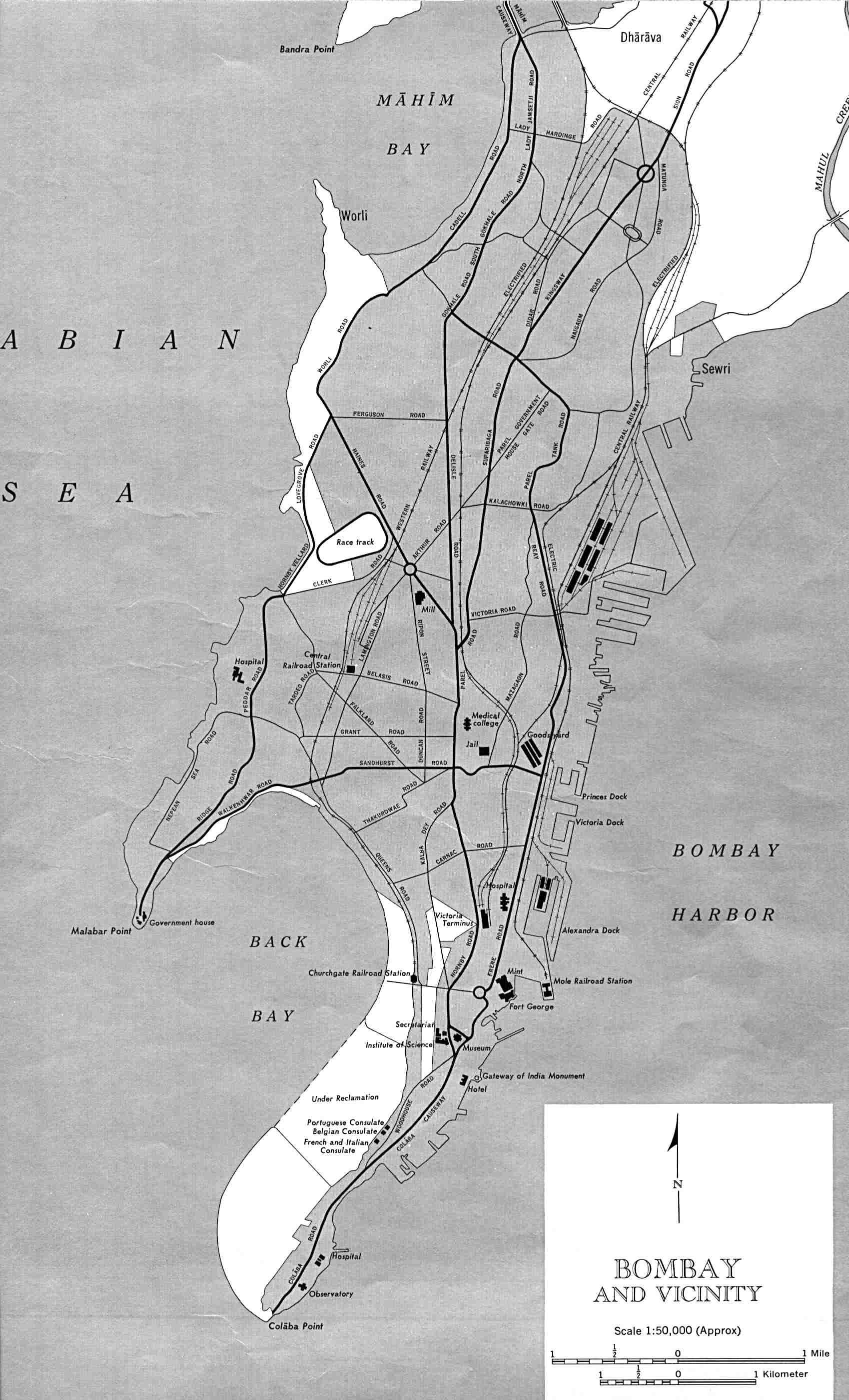
Bombay-india-historical-map-1954-City-Plan
India Maps
 Rivers and lakes India map
 Population map of India 1973
 Relief of India
 Map India
 India topographic blank map
 Delhi and Vicinity histrotical map 1962 City Plan
 India relief map
 India map 1760
 India satellite map
 India regions citys map
 Distribution of christians in Indian states map
 India physical map
 Alphabetisierungsrate indien karte
 State and union territories India map
 Small map of india
 China India border western sector 1988
 India states numbered map
 Indien map 2006
 India
India India comptoirs map
 India languages map
 India map
 India small map
 India numbered stats
 Languages and religions map of India 1973
 India historical map mogul
 Where India located
 Bombay South 1954 Topographic Map
 India natural hazards map
 India geological regions map
 India china border western sector 1980
 India pakistan physical map
 Railway network schematic map
 Cultural regional areas of india map
 South asia India satellite map