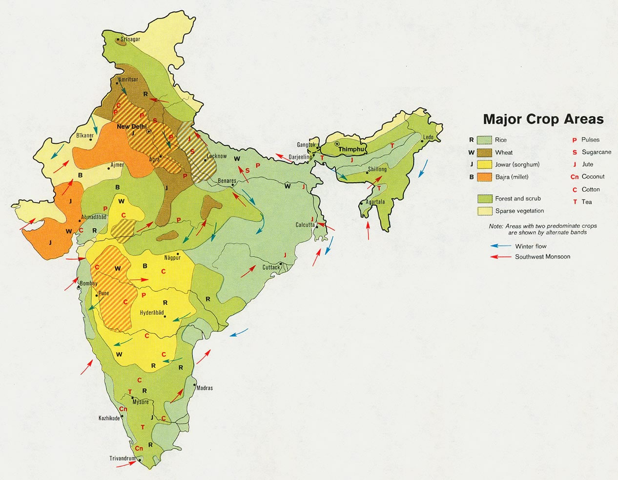
crop-areas-map-of-india-1973
India Maps
 Delhi and Agra Operational Navigation Chart
 India topogaphy
 India climatic zone map
 India airports and seaports map
 India map bbsr direct train full
 Map of India airport city states
 India locator map blank
 India geographical map
 The india map
 Railway network map
 Blank colored India map
 Language travel from India map
 Shared relief map of India 1979
 Bombay North 1954 Topographic Map
 Distribution of christians in Indian states map
 Population map of India 1973
 Political map of India 2001
 India states by rto codes map
 India ter map
 Physical features of India map
 India topographic blank map
 China India border western sector 1988
 india wfb map
 Bombay South 1954 Topographic Map
 Population density India map
 India states numbered map
 Where India located
 India geological regions map
 India numbered stats
 Indian railways map
 India comptoirs map
 Damao Daman 1954 Topographic India Map
 India physical map
 Historical map India 1808
 India historical map