india-numbered-stats
India Maps
 India tourist map
 Delhi and Agra Operational Navigation Chart
 State and union territories India map
 Bhuj Anjar Area Gujarat Topographic Map 1955
 India regions citys map
 Historical maps India in 1804
 Relief of India
 Cultural regional areas of india map
 Historical map India 1808
 India historical map 1700 1792 from The Historical Atlas
 China India border eastern sector 1988
 Small map of india
 India physical
 India china border western sector 1980
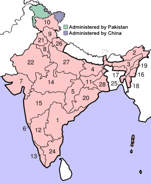
 India states numbered map
 Map of India airport city states
 India energy map 1997
 Population map of India 1973
 India Transportation map
 India physical map
 Karte indien bundesstaaten unionsterritorien
 Historic maps british India
 Bombay India historical map 1954 City Plan
 India geology zones
 India relief map
 Language travel from India map
 Distribution of christians in Indian states map
 India national roads map
 India calcutta map
 Delhi and Vicinity histrotical map 1962 City Plan
 Bombay Map Tactical Pilotage Chart
 Alphabetisierungsrate indien karte
 Physical features of India map
 Population density India map
 Calcutta map 1945 City Plan